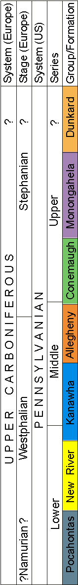
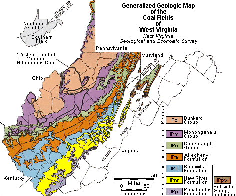
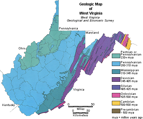
 General West Virginia Geology & Stratigraphy
General West Virginia Geology & Stratigraphy
General West Virginia Geology & Stratigraphy

![]()
![]()
![]()
![]()
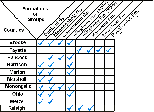
|
|
This table shows which coal-bearing formations occur in the majority of counties mapped to date. Click on a blue check mark to view the coal bed maps.
![]()
![]()
![]()
![]()
Page last revised: April 29, 2009
 Please send questions, comments, and/or suggestions to webmaster.
Page created and maintained by:
            West Virginia Geological & Economic Survey
  Address:  Mont Chateau Research Center
            Cheat Lake exit off I-68
            1 Mont Chateau Road
            Morgantown, WV  26508-8079
Telephone:  304-594-2331
      FAX:  304-594-2575
    Hours:  8:00 a.m. - 5:00 p.m. EST, Monday - Friday
Permission to reproduce this material is granted if acknowledgment is given
to the West Virginia Geological and Economic Survey.